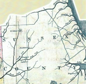
The Doe Bridge Association had its humble beginnings about seven-years ago when I developed the urge to learn more about the area surrounding Doe Bridge. A visit to the State Archives turned up a colonial-period map that showed a road running southwest from Lewes and crossing a large stream north of Millsboro.
I acquired a large copy of an aerial photo from a government agency and immediately saw the remnants of a road, evident even through the canopy of trees. Then, I stumbled upon a copy of a 1795 map that also showed a road running across the area of the old mill and bridge.

I did say Doe Bridge, right? Why this should have been such an awakening, I’ll never know, for where there’s a bridge, there must be a road.
I also recalled hearing about a settlement possibly being located in that same area, before Millsboro was a town. Now I was intrigued and the subject created within me a desire to know more about the area that did not lessen with time.
